Nepal mayhem: ISRO’s satellite images show extent of avalanche that caused floods - The Tribune
4 Articles
4 Articles

In order to establish more precisely what has happened, it will be necessary to wait for new satellite images, especially those made when the weather conditions will allow a sharper view of the area

Nepal mayhem: ISRO’s satellite images show extent of avalanche that caused floods - The Tribune
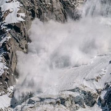
Satellite images released by the Indian Space Research Organisation (ISRO) reveal the extent of the avalanche or landslide that caused the devastating floods in Nepal on August 25. A preliminary analysis by ISRO’s National Remote Sensing Organisation (NRSC) shows a wide swath of changes in the surface of a glacier adjacent to the Trishuli river, […]

Nepal Floods: ISRO has released images of the Trishuli river inundation. The National Remote Sensing Organization has posted the photos taken by RS2A on its website. The images show the Trishuli before and after the floods on August 26.

Satellite images show Nepal before and after devastating flash floods. Listen to the article here. Play Pause Stop /* Modernized button minimized */ .modern-btn { padding: 8px 16px; font-size: 14px; border: none; border-radius: 4px; background-color: #0073aa; color: #fff; cursor: pointer; transition: background-color 0.3s ease; } .modern-btn:hover { background-color: #006799; } /* Popup */ #article-summary-modal { display: none; position: fixed;…
Coverage Details
Bias Distribution
- 50% of the sources are Center, 50% of the sources lean Right


Factuality
To view factuality data please Upgrade to Premium